


Watch southern Donetsk
While the “pro-Russian” OSINT-mongering twaterati can tell you everything you need to know about prospective Ukrainian “offensives” (as is their vocation), it seems entirely unreasonable that they should have a complete understanding of Russian activity in Donetsk, and it’s unlikely that they do.
Apparently, separate from the alternative media expertise, and supposedly thereby unqualified, it is left to the author of this marginalised media alone to question how an army that is otherwise systematist is yet so undisciplined that it acts as a news agency for Telegram channels that they might be able to keep their audience agitated and subscribing to them. There was an excuse at one time for this situation whereby it was said that the Donetsk and Lugansk militia were not under orders to leave social media producing equipment at home, but since these forces have now been incorporated into the Russian military, it should no longer apply.
On the contrary, the author would be amazed if all the information that makes its way to the OSINT-mongers (that is, material that is not the fan-fiction of said purveyors) was not tightly controlled by Russian military intelligence, so that, for instance – and for operational security purposes – it doesn’t have to be current when it shows claims of conquest that nevertheless can be verified geographically by identification of features shown in film footage. There is, it seems, an unreasonable expectation in the OSINT-mongering audience that everything one sees on social media is a fact of the moment. However, the author, when reading and observing the video versions of Russian Ministry of Defence briefings has noticed that lines of control have been put behind towns previously officially claimed as captured, and that other settlements have been gathered within the zone of Russian control even without an announcement (with the same claims also missing from social media, hinting that the military does control what is allowed to be seen). It makes entire sense that such information about pinpointed locations of troops is going to be sensitive for a contemporaneous battlefield, and does not have to be current.
As such, there are two pieces of the Russian presentation alone that are treated at this place as being worth bothering with, and these are, i) the area of control that the Russians describe on an official map and, ii) where the Russians describe Ukrainian movement and where they say Ukrainian depots and command posts are being targeted, with the former of these two being more useful when figuring the position of a front line.
It is this such sort of information that the author has been allowing to accumulate over a few days since 18th November for a presentation on how the Russians have been shaping their situation in southern Donetsk. It’s an important place to watch because of the simple fact that the territory must be retaken to liberate Donetsk – but also because it’s a pivot in the line that the Ukrainians would have to push back in this fabled “Zaporozhe ‘Offensive’” that pro-Russian OSINT-mongery and twaterati is currently making its sucker-for-punishment audience have twitching fits about. The Russians are not going to let this corner of Donetsk become exposed. They won’t let anything resembling a “Zaporozhe ‘Offensive’” do that. It’s simple.
[Continues below the images]
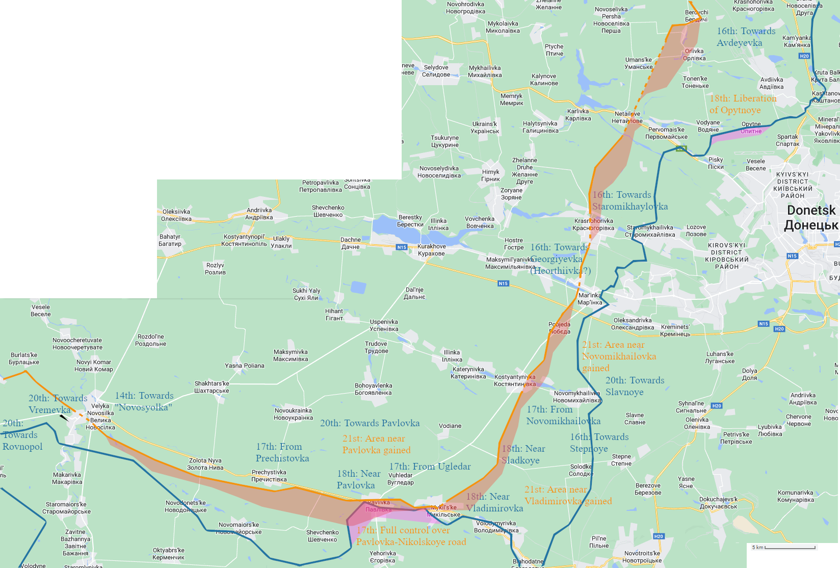
Google map overlaid with Russian MoD claim for front (orange line) on 18th November (with “advance” from 15th in red shading ) and liveuamap’s version of Russian front (blue line) on 18th November (with advance from 17th in purple ) – click to enlarge. [Correction, made 21/12/22: there is a plain Novosyolka on the road westwards from Velyka Novosyolka not very far from it (just off the map). This would be the settlement being referred to.]
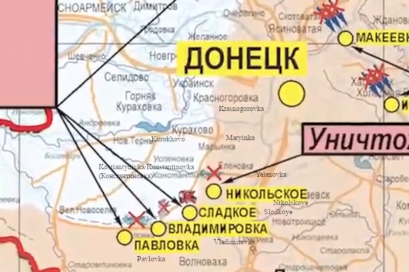
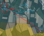
Russian MoD map. 18th November – click to enlarge.
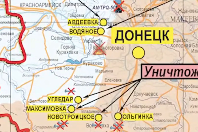
Russian MoD map, 19th November.
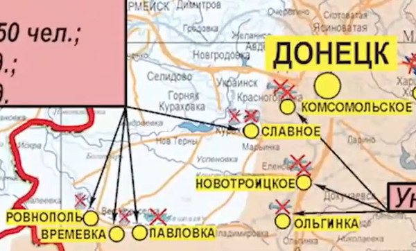
Russian MoD map, 20th November.
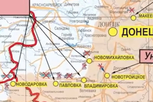
Russian MoD map, 21st November.
While the maps reproduced from Russian Ministry of Defence briefings are to show the raw source material, the focus is on the Google map with lines and annotations overlaid. The orange line showing the Russians view of the front was translated from the MoD map for 18th November – there are notes at the bottom of the page regarding the discernment of the path of this line. The annotations are snippets of information from MoD briefings given on the day stated. When they are in blue they denote a (foiled) Ukrainian attacking manoeuvre. [Incidentally, in all these actions, the Ukrainians lost 585 personnel, 8 tanks, 20 infantry fighting vehicles, 4 armoured personnel vehicles, 20 “motor vehicles” (cars?), 4 pickup trucks, 12 armoured (motor) vehicles and two “lightly armoured towed vehicles”]. When they are in orange they denote a Russian activity or achievement.
Before looking more closely at how the orange line is complimented by the annotated commentary, and what information is imparted by both in concert, attention must be drawn to Novomikhailovka as the only place on the map where the author is uncertain about the position of the Russian front. The confusion comes from the briefing of the 17th where it was stated that the Ukrainians staged an attack from this place. On the 21st the Russians confirmed that an area of territory near Novomikhailovka had been taken by that time, and the Ukrainians were trying to counterattack into it. All one can do is wait and see†, but the author surmises that the town is within the Russian area of control if the Russians have not reached Konstantinovka (Kostyantynivka). With even that being said, Russian forces could be that well advanced, with evidence being how the settlement of Vodiane appears to have been mentioned in the briefing for the 22nd: “In South Donetsk direction, units of Russian forces have hit an enemy mechanised company near Vodyanoye”.
Indeed, the author is not satisfied that the orange line is sufficiently developed in a northern direction in the southern most area of the territory. Omitted from the main map is the official announcement made on 15th November that “a successful offensive by Russian troops has resulted in the complete liberation of Pavlovka”. With the Russians then proceeding to draw their line of control only half way into the town, this is a prime example of the modesty that the makers of the Russian map has routinely demonstrate. The author assumes that Nikolskoye is also taken (and that the Russians control Vladimirovka is also somewhat certain).
Moving north, Pobjeda will be an unknown quantity, but it is possible that the Russians have advanced to form a salient that incorporates it out of Maryinka (even though Telegram channels will have this town yet to be captured) because the Russian Ministry of Defence reported on 16th that the Ukrainians were counter attacking towards Georgiyevka. The author takes this to be the Russian name for Heorhiivka, which is the next settlement along in the conurbation that sprawls towards and includes Kurukhovo in the west (on the shores of the reservoir). Heorhiivka is not labelled, a small stretch of water sits between it and Maryinka (so that there are 3 miles between the centre of each). Obviously, the notion of Ukrainians moving towards Georgiyevka in counterattack implies that the Russian advance has developed that far ahead of Maryinka.
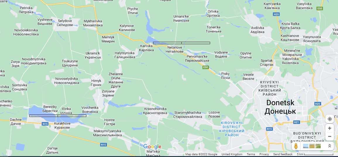
Northwards again, and the Russian maps consistently and positively appear to show the holding of a good portion of Krasnogorovka. Then, if Netailove is not taken, there appeared to be a bulge to the north of it so that the road that goes that way is covered by the Russians. This detail became apparent when the Russians did a rare thing and placed the “Donetsk” label in a more easterly position on 21st November. What we note immediately is the original map label for Avdeyevka is clear, but note it is displaced in the same way that the label for Kurukhovo is.
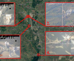
This is perhaps the most controversial part of the map, because it suggests that Avdeyevka is taken by the Russians, while – as far as the author is aware – in the realms of social media it is an ongoing contest of a type akin to that at Artyomovsk. However one can test what is being shown with one’s own eye if one uses a measure based on the length of the Kurukhovo reservoir. In the MoD map for the 21st, the distance from the “Netailove bulge” of the Russian line to the body of water above “Karlivka” (also visible on the MoD map with the label for “Halystsynivka”[?] shown), is one that is not as long as is the reservoir. Now consider the map below where it is revealed that the Kurukhovo reservoir is 6 miles (10 km) long, and that this same distance when applied to start at the “Karlivka” water ends at the outskirts of Vodyane‡. The reader should make of it what he will.
Notes:
When looking at the array of Russian Ministry of Defence maps presented above, one should notice that the basic white map always remains the same. Names of settlements that will have been mentioned in the associated daily briefing are annotated on the map (so these change from one issue to the next), and are placed for the narrative not for the sake of an accurate map (see the placing of Sladnoye on the 20th, for example).
In a lot of case this annotation obliterates that which one is most interested in, which is the extent of the red shading that shows how the Russian Ministry of Defence wants to present its situation. In relation to this problem, on the overlaid Google map (the uppermost image) the reader will notice the orange line becomes dotted to the northwest of Donetsk. This was necessary because the label for the capital city often obscures this area, and was doing so in the MoD map that the author happened to use as source. The line is dotted to indicate a guess. The same is done where the line crosses certain settlements, because the Russian MoD maps can’t impart that sort of complexity when they suggest that the front runs through a built up area.
Regarding the shading itself, the reader will notice that its boundary varies from map to map; again, one must suppose the Russians do not care to be completely precise, and that these maps are most definitely to give an impression – although this by no means that they are suitably representative (which has been best attested to when they have admitted withdrawal).
As explained before in these pages, translation from the Russian MoD maps is tricky for all the reasons given (and also that they need to be rotated in the first instance in order to align with their digital counterparts), but the line that is generated and, in this particular piece presented overlaid on a Google map, is more than sufficiently faithful.
† Update, 26th November, 2022:
The Russian Ministry of Defence’s briefing for this date reads:
In the South Donetsk direction, the enemy attempted to retake the lost position in Novomikhailovka and Nikolskoye (Donetsk People’s Republic).
Artillery strikes and assault groups drove the AFU units back to their original positions.
In addition, an attempt by Ukrainian troops to attack Russian positions in the area of Vremevka was repulsed.
The enemy’s losses in this direction amounted to up to 40 Ukrainian personnel killed and wounded. One tank, two infantry fighting vehicles, and five pickup trucks were destroyed.
‡ Update, 30th November, 2022:
Vodyanoye most likely refers to Vodyane, shown on the Google map used to discuss the status of Avdeyevka. In the Russian MoD briefing of this date, Vodyanoye was again mentioned in the context of a current “successful offensive to liberate” the town.