


Artyomovsk and Soledar
In Donetsk, where the front line incorporates Artyomovsk and Soledar, all the news suggests that the Russians are developing an advance to the south and north of the conurbation. This can’t be discerned in the visual information that the Russian Ministry of Defence imparts in its daily briefings – in terms of showing the extent of controlled territory with red shading, the maps haven’t been altered for weeks. However, despite not being illustrated, certain gains have been explicitly officially announced, and even the pro-Ukrainian liveuamap.com (as recently as yesterday) has had to admit (a version of) Russian progress, so a general gist can be perceived. On top of that, inferences can be made from certain information disseminated in the Russian MoD reports regarding where concentrations of Ukrainian troops have been targeted (and suffered losses).
As the reader will well know, there is a talking point about Artyomovsk that it serves as a “meat grinder” for Ukrainian forces according to prima facia Russian-supporting media, but also as the same for Russian forces according to media that is supporting Ukraine. The upshot is concentration of attention on a stalemate that isn’t actually representative of the conflict as a whole – as discussed in the previous FBEL piece looking at Russian activity towards Kupyansk and Krasny Liman. This article is much in the same vein, and is intended to show that even at the focal point where horns of two armies are supposedly locked to result in high levels of attrition, there is that inevitable Russian progress. Ultimately, the point is to continue casting doubt on the certainty of any “meat grinder” fact. Artyomovsk was only mentioned four times in Russian MoD briefings from the 22nd to 28th December, and only once where a toll in casualties was stated. It is in these reports that Ukrainian losses are officially listed. If these figures do not correspond to what we’d imagine to be the consequence of a “meat grinder”, then such a situation is not suggested – or the Russians don’t know how many deaths are happening, and so in that case, wherefrom comes the justification to make a certain judgment about the situation at Artyomovsk? Social-media OSINT-mongery (perhaps taking its usual wild stab in the dark) may be full of chatter about the clutter of dying and injured at hospitals in Artyomovsk and in close vicinity, but do they know from how far afield these facilities are receiving their intake? Artyomovsk is not physically surrounded. Moreover, can any of this regurgitating “expertise” verify that the scenes that they present of busy ad hoc operating theatres are from Artyomovsk? The answer is probably no.
Indeed, there has always been cause to be suspicious of what the OSINT-mongers say about Artyomovsk – and also Soledar – when for a long time Russian MoD presentations didn’t verify accounts of Russian forces being well advanced into the suburbs. In fact, as the reader can see from the following extract from an August FBEL piece, the author has always doubted the perceptions encouraged about this section of the line of contact, and also the subsequent received thinking:
…if one looks at the Russian MoD map…, the Russians would not appear to have penetrated as deeply – if at all – into the suburbs of Bakhmut (Artyomovsk – APTEMOBCK – is the Russian name) or Soledar (COЛEДAP) as the “expertise” maintains to be the case in another piece of running commentary that it provides. That the Russians aren’t actually trying to capture these towns might explain why they, against expectation, continually don’t. Perhaps what is really happening towards these places is action to pin Ukrainian forces while other attacks to uproot the enemy go in from other places.
Whatever the case was in the past, and whenever it was exactly that them arrived at their current positions, the situation now sees the Russians firmly pressed against Artyomovsk and Soledar, as can be seen in the image below.
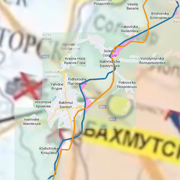
The map probably requires some explanation because it might be a tad confusing. It is based on a graphic published on the last occasion that this fraction of the front was covered in November and in the article, The Russian Winter Campaign Has Evidently Already Started (?). The idea was to demonstrate how a Russian MoD map could be overlaid onto a more detailed chart to gain a more accurate representation of the claims of areas under Russian control shown therein. Because, as mentioned above, the Russians have not updated their maps in this respect, this older map is as current as anything that could be created again from scratch.
The essential original content is the orange line showing the Russian situation, and its relation to Artyomovsk (Bakhmut) and satellites, Soledar, “Pokrovs’ke” and “Volodymyrivka”.
This version is made different by the addition of other material. Firstly, there is the inclusion of settlements to the northeast of Soledar and southwest of Artyomovsk. Secondly, there is the blue line, which is the Ukrainian (liveuamap) reckoning of the Russian front on 28th December. The purple shading is territory that the same reckoning indicates was gained by the Russians from 27th December.
With this having been established it can be seen that neither the Russians or the Ukrainians illustrate the settlement of “Yakovlivka” as having changed hands despite the former stating its liberation in a MoD briefing of 18th December, and the latter acknowledging a conformational report earlier than that on 16th December. Also not shown as being captured by the Russians is Andreevka, taken at the end of November, which sits south of Kleshchiyevka (“Klishchiivka”). This settlement can be seen as a grey square on the Ukrainian side of the front line (both versions). The point is, then, because of denial on the Ukrainian side and for misdirection (presumably) on the Russian side, the maps aren’t necessarily going to be entirely accurate negatively or positively in respect of Russian progress.
It’s just as well that there is another indicator that one can use (and which has always been used in FBEL’s coverage of the Special Military Operation) which is content of the Russian MoD’s daily briefings. Explanation has been provided on other occasions hereabouts as to why it is good source material, so there’s little inclination to keep repeating it. Suffice it to say, the information makes sense in the context of other data and is reasonable in that same way, but also in how it is presented.
With that then established, please consider the following extracts from briefings given on the 18th and 24th December respectively in conjunction with the graphic shown above.
[18th:] In Donetsk direction, as a result of the offensive actions of Russian troops, the settlement of Yakovlevka (Donetsk People’s Republic) has been taken under control. It is currently being cleared of the remnants of Ukrainian troops. The enemy conducted unsuccessful counterattacks to regain its lost positions close to Podgorodnoye, Kleshchiyevka, and Kurdyumovka (Donetsk People’s Republic) The counterattacks were repelled by artillery strikes and Russian assault groups. The enemy suffered casualties and was pushed back to the initial positions. More than 40 Ukrainian personnel, two armoured fighting vehicles, and three automobiles were eliminated…
[24th: ] In Donetsk direction, the Russian troops destroyed a combined tactical group of foreign mercenaries and defeated units of the 10th Mountain Assault Brigade of the Armed Forces of Ukraine near Razdolovka (Donetsk People’s Republic). The enemy lost up to 60 Ukrainian military and mercenaries, four armoured personnel carriers, and three pickups.
The first detail to point out is that regarding Ukrainian positions lost “close to” Podgorodnoye, Kleshchiyevka, and Kurdyumovka. The first two of these are on the map: “Pidhorodne” and “Klishchiivka”. Kurdyumovka is more south than the map allows, and is a known factor. All sides recognise it as having been captured by the Russians. Just because of how the terminology is applied in the same way to all three settlements, it is possible that the situations at Podgorodnoye and Kleshchiyevka are being suggested as resembling that at Kurdyumovka. The key word is “resemble”, it must be stressed. It isn’t being claimed that these two other settlements have been fully liberated by the Russians. And of course we should note that in their map the Russians don’t claim to be as close to Podgorodnoye as the Ukrainians reckon.
The second detail is that regarding the destruction of Ukrainian forces near Razdolovka which were not mentioned in connection with any activity they were undertaking. This could mean, and indeed strongly suggests that the Russians attacked them in their defensive positions. Razdolovka is barely shown on the map in its northernmost parts, west of “Vesele”. The distance between Yakovlevka and Razdolovka is between 4 and 5km, or 2 and a half to 3 miles. One naturally wonders if and by how much the Russians have made inroads in this particular direction. In any case, it certainly is a matter of fact that the enveloping of Artyomovsk and Soledar is becoming more pronounced, and this is due to the matter of fact of Russian activity and more fundamentally progress. There is no inertia.
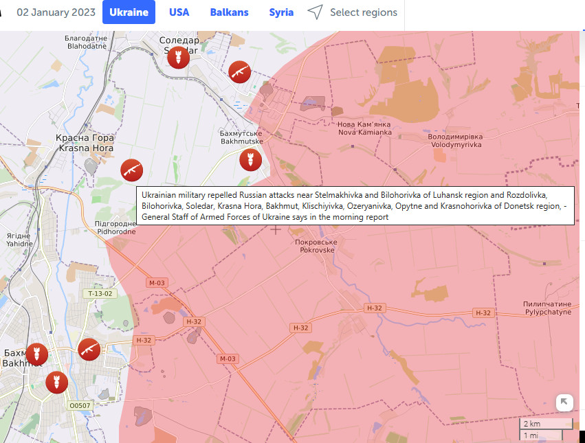
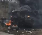
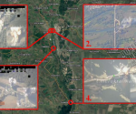
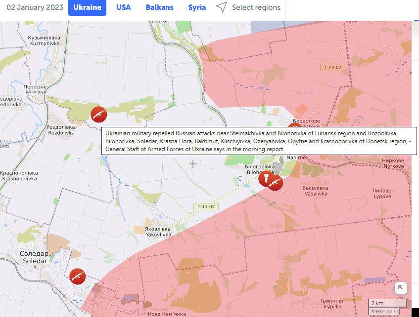
Update, 2nd January 2023:
Being reported today by the Ukrainians, a Russian attack near Razdolovka:
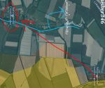
And the Russians are also at the gates of Krasnaya Gora (Krasna Hora):